GPS Navigation in Slot Canyons: Signal Loss Solutions
By Keiko Tanaka • 28th Apr
GPS navigation in slot canyons and canyon GPS tracking solutions demand a fundamentally different approach than open-country navigation. The problem isn't complexity; it is that vertical walls, narrow passages, and layered stone rob satellite signals of the line-of-sight geometry they need. Your device doesn't fail because it's defective; it fails because the canyon itself blocks, bounces, and delays the very radio waves that fix your position. Understanding this shift changes how you prepare.
Why Slot Canyons Break GPS
Slot canyons are GPS denial zones. Rock walls above bounce signals back to your receiver out of sequence (what's called multipath error). Your device locks onto the delayed bounce instead of the direct signal. The result: position jumps of 30, 50, even 100 meters. In a 15-foot-wide canyon with two possible routes, that's the difference between the trail and a dead end.
Additionally, the satellite geometry degrades. GPS works best when satellites are spread across the sky. Slot canyons reduce the sky to a stripe. Your device might see only three or four satellites instead of eight. For a deeper explainer on why multi-band receivers help in canyon-like conditions, see our multi-band GPS guide. That's not enough for reliable 3D fixes. Elevation especially becomes suspect, and the vertical component of the error swells.[1] When your watch or handheld reads a 400-meter gain where you walked 200, the barometric altimeter failed or the GPS elevation was too noisy.
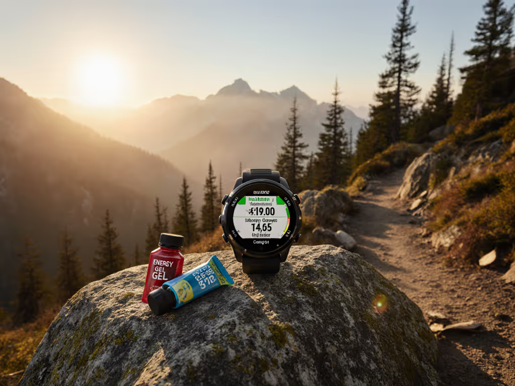
Cell service is absent. When I'm on Hole in the Rock Road headed toward Zebra or Tunnel Slot, the phone drops to nothing miles before the trailhead.[1] A downloaded offline map isn't optional (it is the foundation). Set yourself up with watch-based maps using our field-tested topo mapping guide. Delay kills decisions. If you wait until the canyon floor to realize you need a map, you're already confused.[1]
The Multi-Layer Redundancy Model
Precision navigators in canyons use layered fallbacks. First: a GPS app with offline maps downloaded to your phone or watch. Gaia GPS is the field standard because the app stores track logs and lets you record a "breadcrumb trail" on the way in (critical insurance if you lose sight of cairns or heat exhaustion sets in).[1][3] The breadcrumb is not navigation; it's a literal path home. For full setup and route-finding tactics that minimize drift, read GPS watch navigation in wilderness canyons.
Second: a paper topographic map and compass. Paper doesn't buffer, doesn't charge, doesn't glitch. In a slot canyon, where you might be moving on slickrock with no footprints, a map lets you read terrain shape and estimate position by triangulation.[1][5] This is the true failsafe. Many guides carry both map and GPS, not from redundancy ideology but from experience watching devices overheat or lose signal lock just when the route became ambiguous.
Third: external reference points. Mark your vehicle location with a GPS pin before you leave the trailhead.[1] If you need a true SOS backup, compare watches with emergency location sharing tested off-grid. If your phone dies in the canyon, you know the azimuth and distance home. Plan for the device to fail; assume the human brain will navigate on shape and sun angle.
Signal Loss Under Canyon Walls: What Actually Happens
- Early canyon sections: usually adequate satellite locks because you still have sky access. GPS is near-normal.
- Narrow middle sections: multipath dominates. Fixes wander. Elevation spikes or falls. Your watch recording altitude-based intervals (every 100 meters) triggers inconsistently. Task time to fix a wandering track on the hike out: 5-15 minutes per loop, because you're visually comparing the recorded path to the cairns and terrain.
- Deep slot junctions: GPS may fail entirely. Your device shows "searching" or locks to just two satellites (useless). This is where the cairns matter, and where recorded breadcrumb trails save time.
The key observation: GPS doesn't fail gracefully in slots. It either works or it doesn't; degradation is binary after a certain depth.[7] A device showing "2 meters accuracy" in a slot is lying. Trust it at your peril.
Practical Pre-Canyon Workflow
On the phone, before leaving cell coverage:
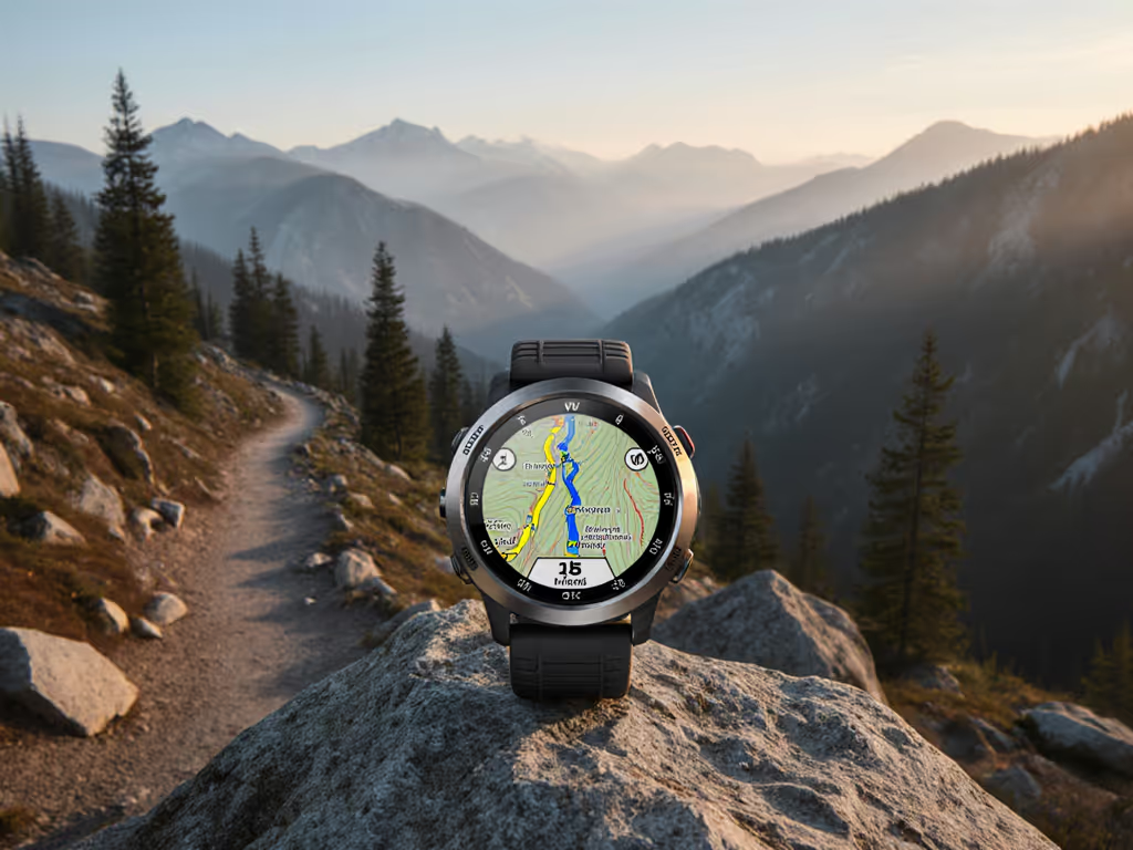
- Open Gaia GPS (or equivalent offline map app) and download the canyon area at zoom level 15-16. This resolution shows canyon outlines, wash networks, and trailhead markers.[1]
- Load the GPX file for your intended route. Gaia stores these locally. Confirm the file exists offline; don't rely on cloud sync in the field.[2]
- Scout satellite views (Google Earth) of the approach road and surrounding terrain. Identify landmark badlands or ridge shapes you'll recognize from the canyon floor.[1]
- Print a 1:24,000 or 1:50,000 topographic map of the area. Mark your trailhead, planned route, and water sources in pencil. Fold it to show your section, not the whole map (it reduces fiddling).
- Before descent, enable track recording on your GPS app. Start fresh for each leg. Stop and restart at canyon junctions to segment the breadcrumb into legible chunks.
On the device, at the trailhead:
- Set your watch or GPS to record tracks at standard 1-second intervals, not 10 seconds. In a slot, 10 seconds means you miss a crucial turn. One-second intervals eat battery, but battery management below ground is academic (you're not getting another charge until you're out).
- Enable barometric altimeter only if you calibrated it within the last 24 hours (use our barometric calibration fixes to avoid elevation drift). If weather changed overnight, the altimeter is guessing and will worsen your elevation confidence. Mark the barometric reading on your paper map; use it as a tiebreaker, not gospel.
- Disable auto-lap and auto-scroll on watches. These features assume predictable movement. In a slot where you backtrack and explore, they'll fire randomly and waste cognitive energy. Manual lap markers at turnarounds are faster and clearer.
Canyon Terrain and Vertical Wall GPS Accuracy
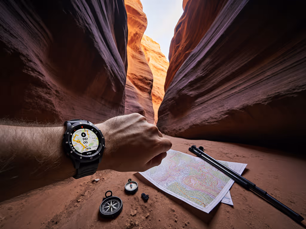
The multipath and signal-bounce problem is most acute on north-south slot canyons where walls track the same bearing as your phone's antenna.[1] East-west slots tend to hold slightly better GPS coverage because one wall is closer to zenith (less direct bouncing back to your receiver).
Vertical climb routes within slots degrade GPS further. As you ascend slickrock, your device tilts; the antenna pattern changes. Many runners and guides have noticed (confirmed in real field testing) that watches with externally mounted antennas hold locks longer than those with antennas buried in the case. This matters at depth. A handheld GPS with a tall antenna may outperform a wristwatch in the bottom 200 meters of a deep slot, even if the watch is technically a "better" model overall.
Narrow passages force a choice: is it faster to wait for a satellite lock and navigate on map, or to rely on the breadcrumb and cairn-hop? In slots, cairns usually win. If I can't feel it, I can't trust it.[1] If I can't see the cairn, the breadcrumb is my real map, not the GPS.
Actionable Next Step: Assemble and Test Your Offline Stack
- Download offline maps for your intended canyons in Gaia GPS or CalTopo. Test that the app opens and displays offline without searching for internet. Verify zoom is adequate to identify your route.
- Obtain a printed topographic map of the same area. Study it for 10 minutes; familiarize yourself with the canyon structure, water sources, and bailout points.
- Load your route as a GPX file into both your phone app and your watch or handheld GPS. If your watch doesn't accept GPX directly, practice transferring it via the manufacturer's app or cable (before you're in the field).
- Record a test track on a familiar local trail or urban canyon. Play it back. This is your baseline. You'll recognize the shape when you're tired and disoriented.
- Walk a practice slot with a friend (something short and well-marked) so you experience real multipath errors and dropped fixes in a low-stakes environment. Observe exactly when your device loses lock. Note the sky stripe angle. This visceral learning beats any article.
GPS in slot canyons is a solved problem when you accept that satellite signals are unreliable and you build a three-layer system: offline digital map + paper map + breadcrumb track. Controls must work without the device. Plan on your map making the call, not your screen. The canyon itself will teach you the limits of the technology; respect that boundary, and your GPS becomes a tool again instead of a false god.
Related Articles